Monday, April 29, 2013

Surigao del Sur


Surigao del Sur is a six-hour drive from Davao City.

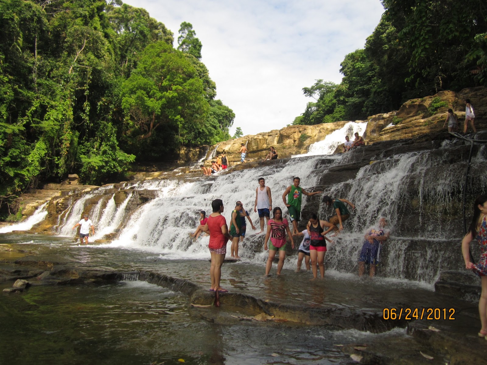
Tinuy-an Falls. Located in Bislig City, Surigao del Sur, Tinuy-an Falls is touted as the Niagara Falls of the Philippines. It was recently featured in TV Patrol as a top tourist destination in Surigao. It is said to be the widest waterfall in the Philippines. (Source: Wikipedia)

Tinuy-an Falls has three levels, and people could climb up to the second tier if one had the strength to climb steep metal stairs. The rocks in the falls were slippery, but if you trod carefully you could reach spots where you could sit and let the cascading waters massage your back.


Locals swimming in a rainbow


Enchanted River. This river in Hinatuan, Surigao is by far the most amazing and breathtaking place I've been to in the country. The middle part is said to be 80 feet deep, and if you look down, you can't see the bottom.  It's been featured in a few local travel shows, so its popularity is increasing.

The varying shades of blue were absolutely mesmerizing, and, were it not for the big Sunday crowd, it would have been eerie, too. The brackish water was cold at first, and we were terrified to swim the width of the river because of the dark blue water in the middle. But after some time, our bodies adjusted to the temperature and we summoned the courage to swim to the other side, the quickest dog paddle I've ever done in my entire life. Two of us even cliff-dived. \m/


Britannia Islets. 


Hagonoy Island
An abandoned hut
Naked Island, which was one long sand bar


A fitting farewell to a great Surigao adventure
24 June 2012

Sunday, April 28, 2013

Mt. Pinatubo

Mt. Pinatubo. What was considered a dormant volcano shook the world in 1991 when it "produced the second-largest terrestrial eruption of the 20th century." (Source: Wikipedia) Now, tour groups offer trekking trips to the crater of Mt. Pinatubo, a two-hour hike from the base. People can swim in the lake which has a depth of thousands and thousands of feet, although DOH recently issued a warning against the harmful substances found in the crater lake after a man drowned. So.

To get to the base, hikers have to ride a 4x4 ATV for around forty-five minutes through streams and rocks which trace the path of pyroclastic flow and lahar after the eruption. During the trek, you will see streams tinged with yellow, caused by sulfur from the volcano.

Tip: Wear old, comfortable trekking sandals. I got blisters from wearing a brand new pair. Rubber shoes not advised as you may have to wade through streams.

A tour guide clinging to the hood of a 4x4
It was a bumpy ride to say the least 
The crater lake lies beyond those twin peaks

Sulfur


The lake up close
Aeta children
5 May 2012

Wednesday, April 24, 2013

Philippine Taoist Temple, Cebu

Philippine Taoist Temple. Located in Beverly Hills, Lahug, Cebu City.


12 December 2011

Bantayan Island, Cebu

Bantayan Island. It is located north of San Remigio, the northernmost part of Cebu. To get to Bantayan, you can rent a van from Mactan Airport (advisable for a big group), or take a bus to San Remigio. Board the ferry from Hagnaya Wharf to Santa Fe, an hour-long trip. You can rent a bike to tour the island, for a more fun experience.

We went there on December, so there weren't a lot of visitors around (peak season is Holy Week). Hence, we enjoyed a peaceful afternoon with the beach almost to ourselves. :)

Its famous sandbar


Virgin Island, a boat ride away
10-12 December 2011

Cebu City

Cebu City. The Queen City of the South, known for its guitars, dried mangoes, otap, and danggit. It's highly-urbanized, dense, polluted, and easily-flooded--basically like Manila but with a different language.

Magellan's Cross. Historian Ambeth Ocampo said the original cross was lost, which makes me wonder what is on display. But that doesn't stop tourists from flocking to it anyway.


Basilica Minore de Sto. Nino


Cebu Metropolitan Cathedral


The Terraces, Ayala Mall


22-23 November 2011